


Atmosphere 2024, 15(5), 516; https://doi.org/10.3390/atmos15050516 - 23 Apr 2024
Abstract
Located in the central part of the arid regions of Northwest China, the Heihe River Basin (HRB) plays an important role in wind prevention, sand fixation, and soil and water conservation as the second largest inland river basin. In the context of the
[...] Read more.
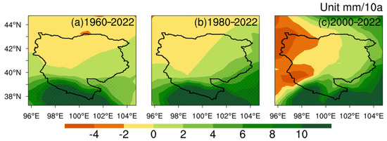
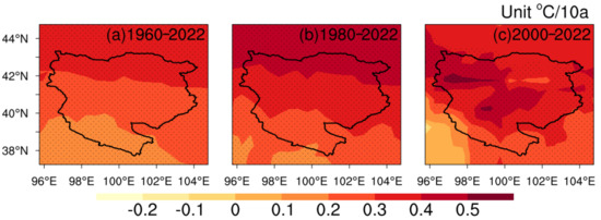
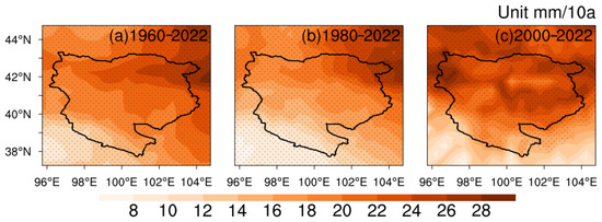
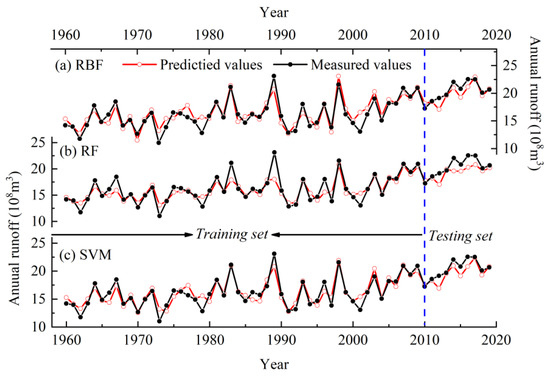
Located in the central part of the arid regions of Northwest China, the Heihe River Basin (HRB) plays an important role in wind prevention, sand fixation, and soil and water conservation as the second largest inland river basin. In the context of the warming and wetting climate observed in Northwest China, the situation of the ecological environment in the HRB is of significant concern. Using the data from meteorological observation stations, grid fusion and hydrological monitoring, this study analyzes the multi-scale climate changes in the HRB and their impacts on runoff. In addition, predictive models for runoff in the upper and middle reaches were developed using machine learning methods. The results indicate that the climate in the HRB has experienced an overall warming and wetting trend over the past 60 years. At the same time, there are clear regional variabilities in the climate changes. Precipitation shows decreasing trends in the northwestern part of the HRB, while it shows increases at rates higher than the regional average in the southeastern part. Moreover, the temperature increases are generally smaller in the upper reaches than those in the middle and lower reaches. Over the past 60 years, there has been a remarkable increase in runoff at the Yingluo Gorge (YL) hydrological station, which exhibits a distinct “single-peak” pattern in the variation of monthly runoff. The annual runoff volume at the YL (ZY) hydrological station is significantly correlated with the precipitation in the upper (middle) reaches, indicating the precipitation is the primary influencing factor determining the annual runoff. Temperature has a significant impact only on the runoff in the upper reaches, while its impact is not significant in the middle reaches. The models trained by the support vector machines and random forest models perform best in predicting the annual runoff and monthly runoff, respectively. This study can provide a scientific basis for environmental protection and sustainable development in the HRB.
Full article
(This article belongs to the Section Climatology)
►
Show Figures
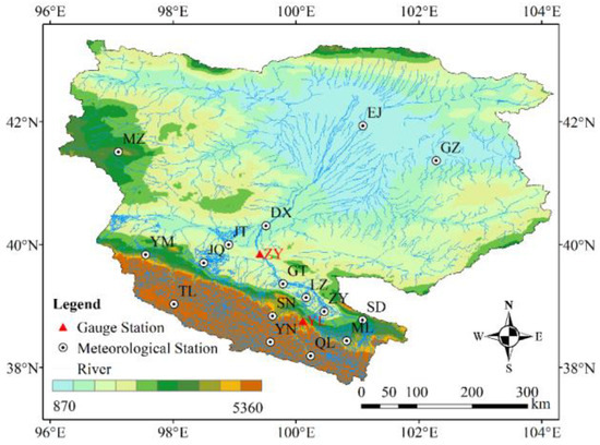
Figure 1


