

Geosciences 2024, 14(5), 115; https://doi.org/10.3390/geosciences14050115 - 24 Apr 2024
Abstract
►
Show Figures
Heterogeneous rock masses that include rhythmic alternations of marl, shale, marly limestone, sandstone, siltstone, and argillite, such as Flysch, are particularly prone to generating colluvial deposits on gentle slopes, which are often subject to failures triggered by heavy rainfall. Flysch-derived colluvial soils are
[...] Read more.
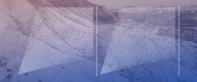
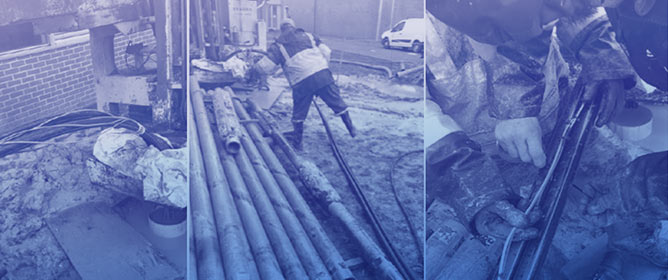
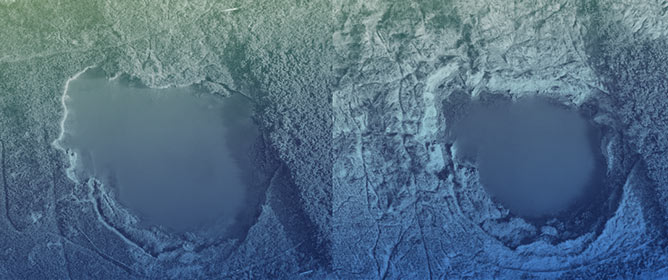
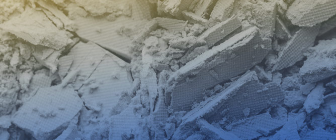
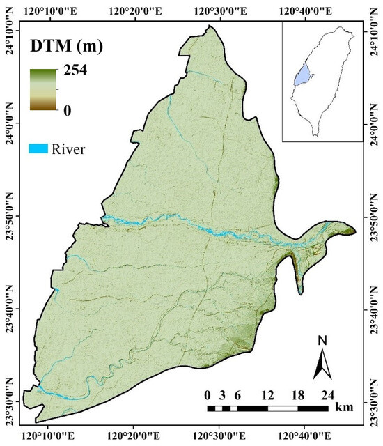
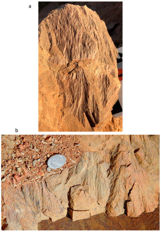
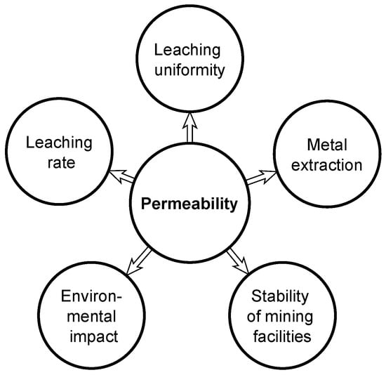
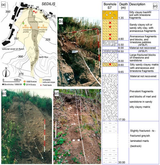
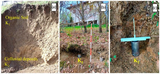
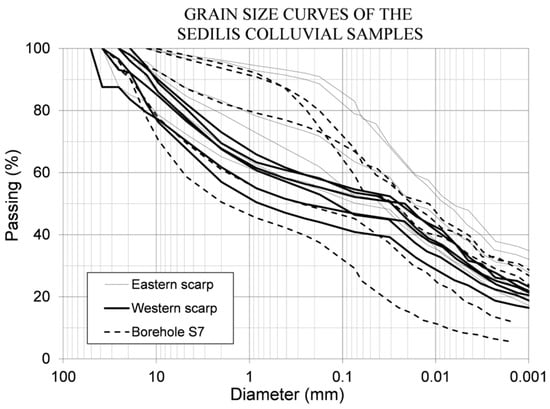
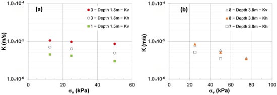
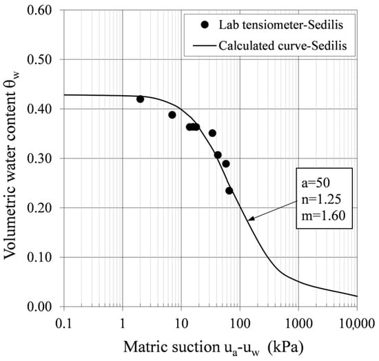
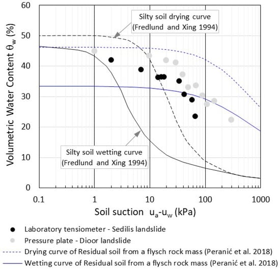
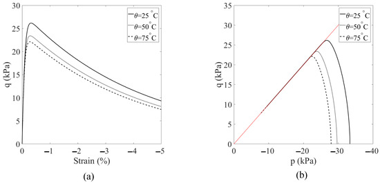
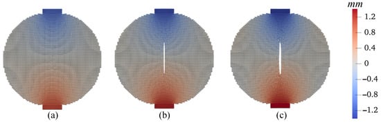
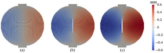
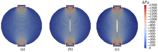
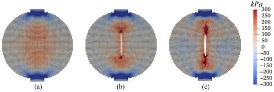
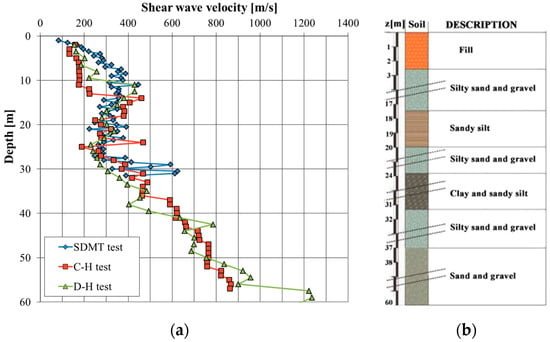
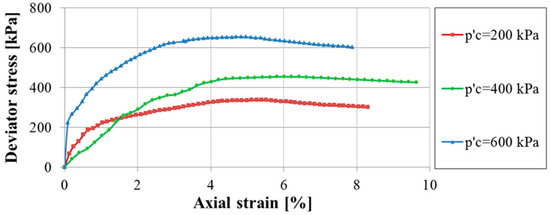
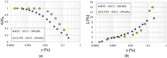
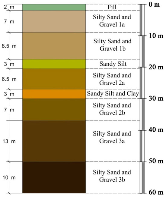
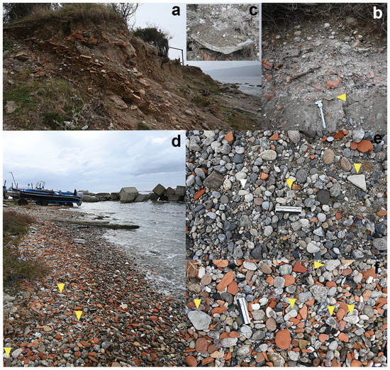
Heterogeneous rock masses that include rhythmic alternations of marl, shale, marly limestone, sandstone, siltstone, and argillite, such as Flysch, are particularly prone to generating colluvial deposits on gentle slopes, which are often subject to failures triggered by heavy rainfall. Flysch-derived colluvial soils are made up of highly heterogeneous sediments ranging from clayey loam to rock fragments, and they have been studied more rarely than homogeneous soils. In this work, we present a geotechnical and hydraulic characterisation performed both in situ and in the laboratory on flysch-derived colluvial soils that were involved in a channelised landslide in the pre-alpine area of the Friuli Venezia Giulia region (NE Italy). The investigated soils were characterised by the average values of the grain size composition of about 25% gravel, 20% sand, 30% silt, and 25% clay. The loamy matrix presented low-to-medium values of the liquid and plastic limits, as well as of the plasticity index (LL = 40%, PL = 23%, and PI = 17%, respectively). The values of the peak friction angle for natural intact samples were 33° < ϕ’p < 38°, whereas the residual friction angle fell to 23–24° at great depths and high vertical stresses, for a prevailing silty–clayey matrix. Variable head permeability tests were performed both in situ and in the laboratory, showing that the values of the vertical and horizontal permeability were very close and in the range 1 × 10⁻⁴–1 × 10⁻⁶ m/s. The soil permeability measured in the field was generally higher than the hydraulic conductivity calculated on laboratory samples. The proposed geotechnical and hydrological characterisation of flysch-derived colluvial soils can be of fundamental importance before the use of more thorough analyses/models aimed at forecasting the possible occurrence of slope failures and evaluating the related landslide hazard. The reported geotechnical and hydraulic parameters of flysch-derived colluvial materials can represent a useful reference for rainfall infiltration modelling and slope stability analyses of colluvial covers that are subject to intense and/or prolonged precipitation. However, when facing engineering problems involving colluvial soils, particularly those coming from flysch rock masses, the intrinsic variability in their grain size composition, consistency, and plasticity characteristics is a key feature and attention should be paid to the proper assumption of the corresponding geotechnical and hydraulic parameters.
Full article
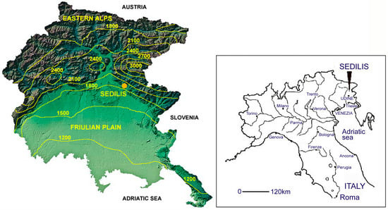
Figure 1


