


Water 2024, 16(9), 1203; https://doi.org/10.3390/w16091203 (registering DOI) - 24 Apr 2024
Abstract
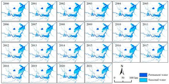
The precipitation on the northern slope of the Kunlun Mountains significantly impacts the green economy of the Tarim Basin’s southern edge. Observations have noted an expansion of the surface water area in this region, though the reasons for this are not yet fully
[...] Read more.
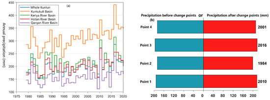
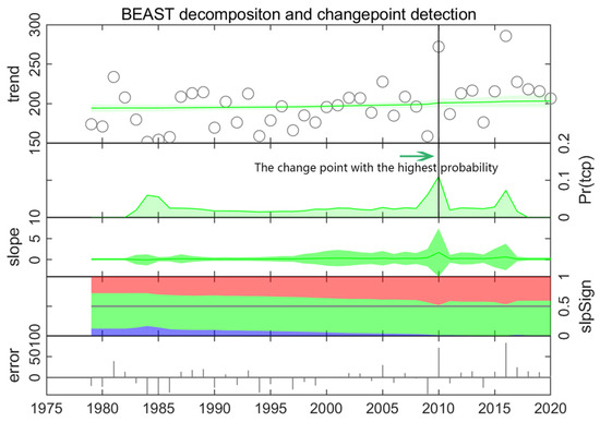
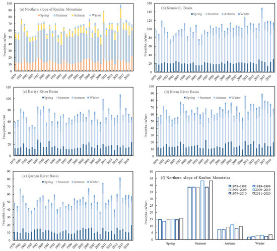
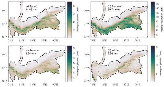
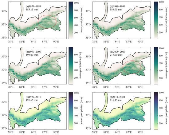
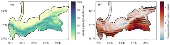
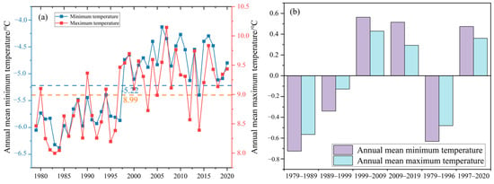
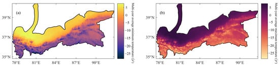
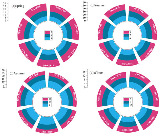
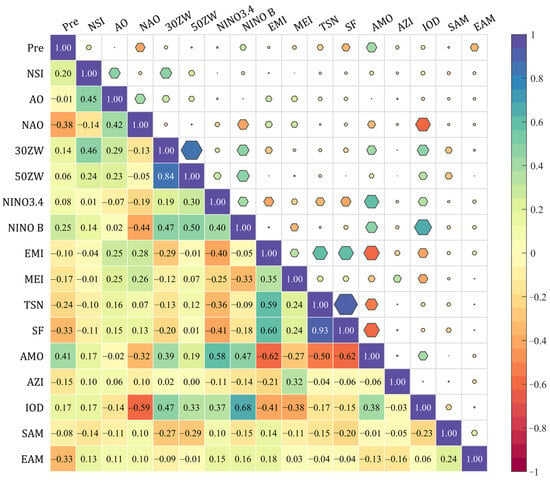
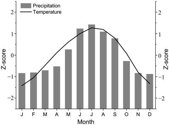
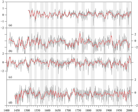
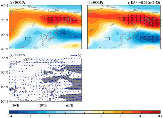
The precipitation on the northern slope of the Kunlun Mountains significantly impacts the green economy of the Tarim Basin’s southern edge. Observations have noted an expansion of the surface water area in this region, though the reasons for this are not yet fully understood. Due to limited instrumental data, this study leverages field measurements from the third Xinjiang comprehensive expedition and multiple gridded datasets. Through trend analysis and a geographical detector model, it examines the precipitation’s decadal, interannual, and seasonal variations across key areas (Hotan River Basin, Keriya River Basin, Qarqan River Basin, and Kumukuli Basin), identifying factors behind the spatial and temporal distribution of regional precipitation. The findings reveal the following: (1) An increase in annual precipitation across the region from 187.41 mm in the 1980s to 221.23 mm in the early 21st century, at a rate of 10.21 mm/decade, with the most significant rise in the eastern Kunlun-Kumukuli Basin. (2) Precipitation exhibits clear seasonal and spatial patterns, predominantly occurring in spring and summer, accounting for 90.27% of the annual total, with a general decrease from the mountains towards downstream areas. (3) Rising average annual temperatures contribute to an unstable atmospheric structure and increased water-holding capacity, facilitating precipitation. Significant influences on precipitation changes include the North Atlantic Oscillation and solar flux, explaining 43.98% and 31.21% of the variation, respectively.
Full article
(This article belongs to the Section Water and Climate Change)
►
Show Figures
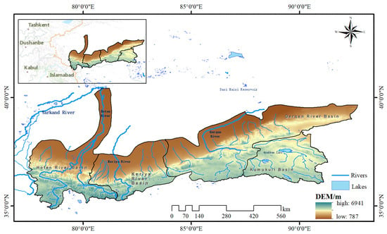
Figure 1


