


Land 2024, 13(5), 568; https://doi.org/10.3390/land13050568 (registering DOI) - 24 Apr 2024
Abstract
►
Show Figures
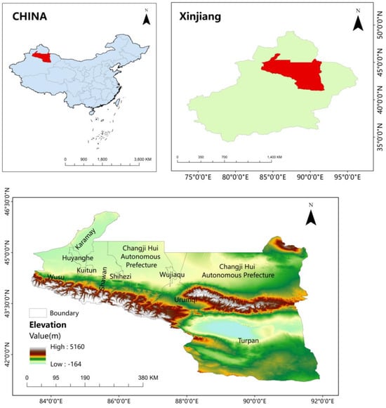
With the escalating global climate change and frequent human activities, Inner Mongolia, as a crucial ecological barrier in the Beijing-Tianjin-Hebei region, Bohai Economic Rim, and even the whole country, confronts many ecosystem issues. To reveal the intricate interplay between natural processes, human activities,
[...] Read more.
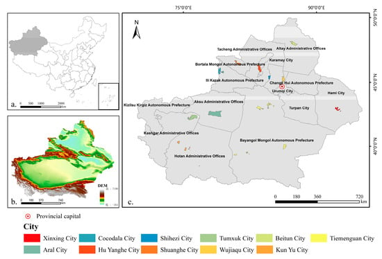
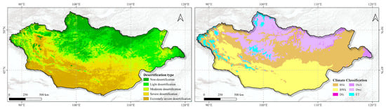
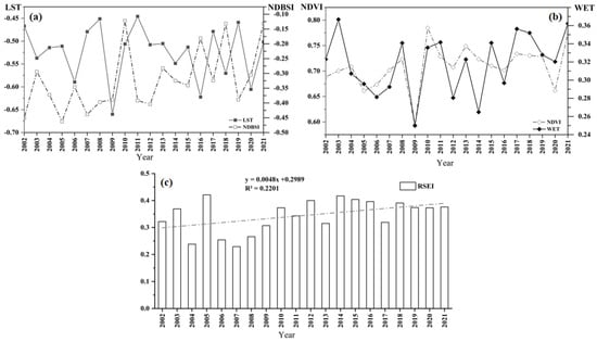
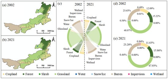
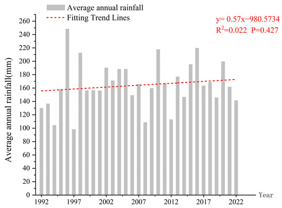
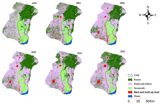
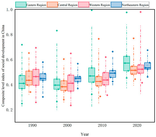
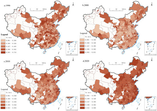
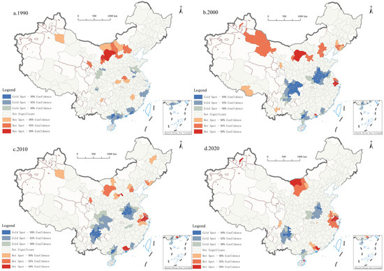
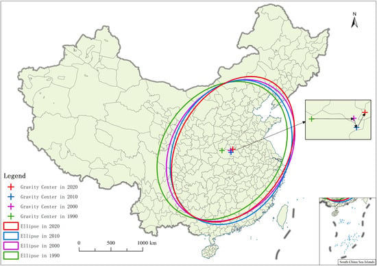
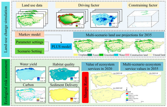
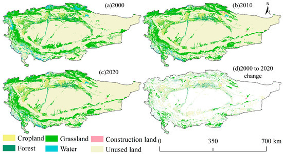
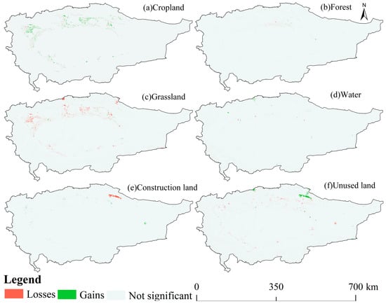
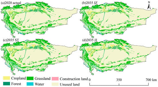
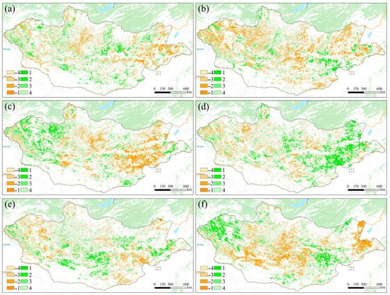
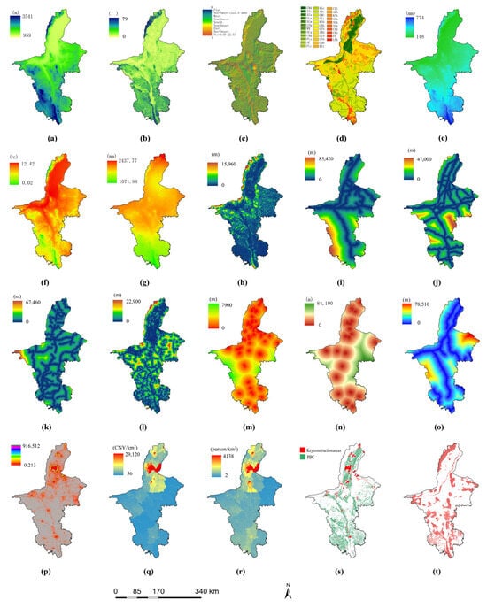
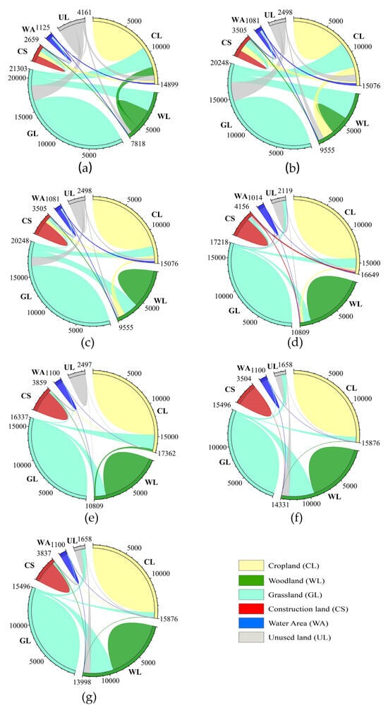
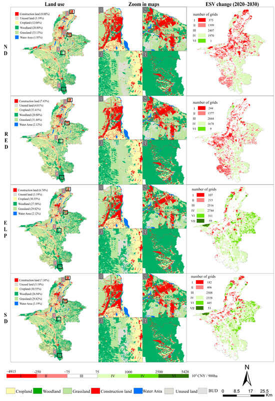
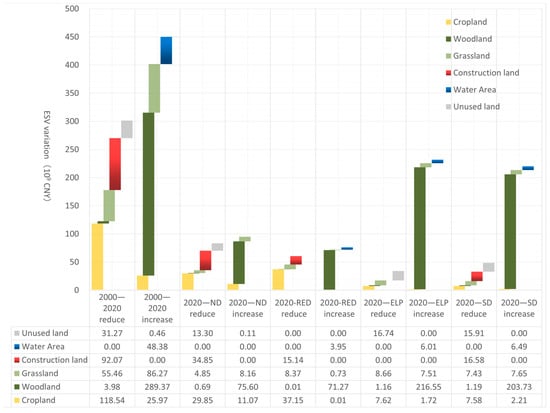
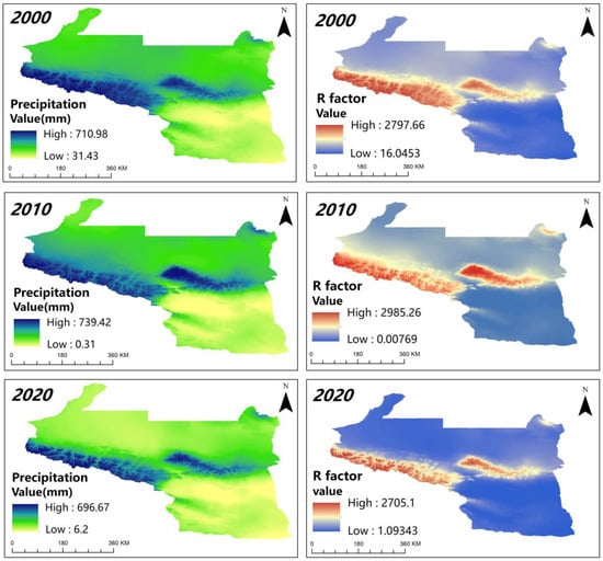
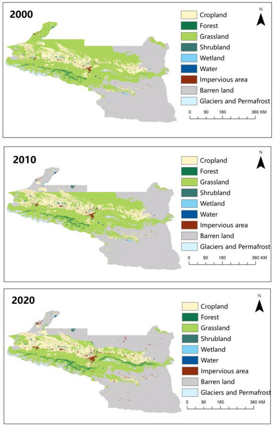
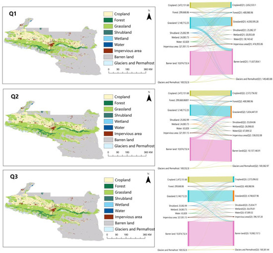
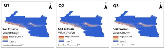
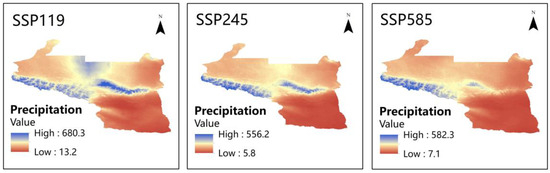
With the escalating global climate change and frequent human activities, Inner Mongolia, as a crucial ecological barrier in the Beijing-Tianjin-Hebei region, Bohai Economic Rim, and even the whole country, confronts many ecosystem issues. To reveal the intricate interplay between natural processes, human activities, and policy interventions shaping the region’s ecological landscape, we provide a comprehensive analysis of ecological quality in Inner Mongolia from 2002 to 2021. Key findings include: (1) The research uncovers an overall improvement in ecological quality across Inner Mongolia, albeit with certain regions exhibiting a pattern of deterioration followed by improvement, particularly notable in the central part of the province. (2) Cropland, shrub, grassland, barren, wetland, and water are decreasing, while impervious, and forestland are increasing. (3) Precipitation, temperature, and elevation are significant drivers affecting the quality of the ecological environment. Interestingly, while human production and activities have altered ecological conditions, factors like GDP, population density, and night lighting index do not directly impact environmental quality significantly. This underscores the intricate interplay among various factors within the socioeconomic system, highlighting its complexity. (4) Based on these findings, our policy recommendations include strengthening ecological monitoring and management, promoting sustainable urban development, conducting public education and awareness campaigns, and fostering stakeholder collaboration for data sharing and collective understanding. Adopting sustainable management strategies is essential for promoting ecological resilience and mitigating environmental degradation in Inner Mongolia, not only benefiting the local ecosystem but also contributing to national and global environmental well-being.
Full article
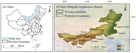
Figure 1


