

Hydrology 2024, 11(4), 57; https://doi.org/10.3390/hydrology11040057 - 19 Apr 2024
Abstract
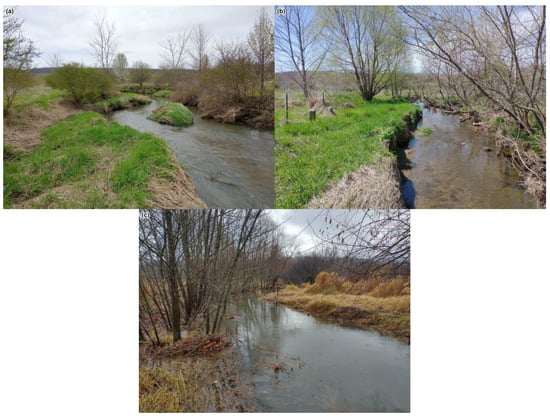
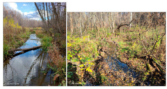
This study sought to estimate the potential impact of floodplain forest vegetation on sediment and phosphorus loading along the Iowa River in Iowa, USA. Thirty monitoring plots were established in forested conservation easements and similar public land along the Iowa River within the
[...] Read more.
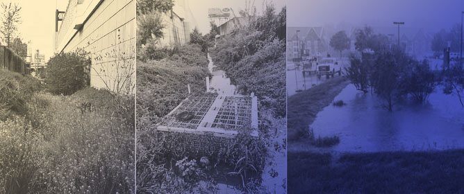
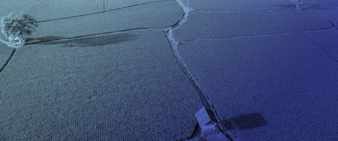
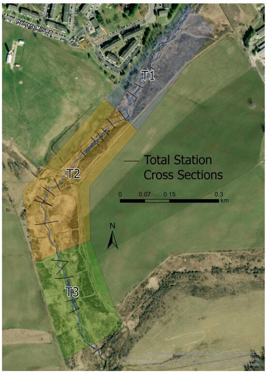
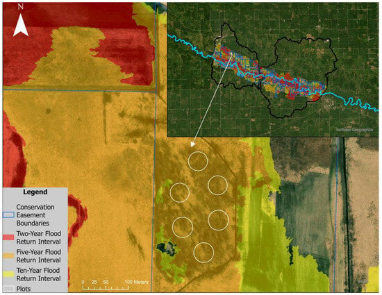
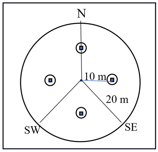
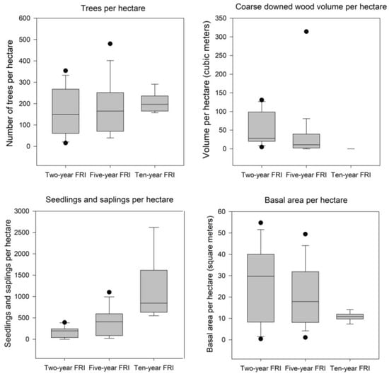
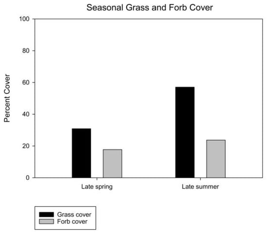
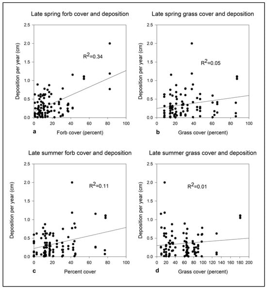
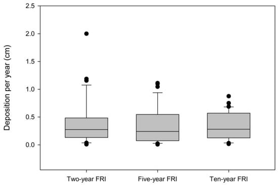
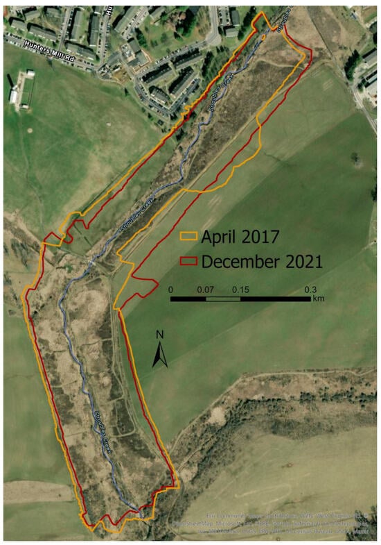
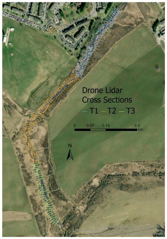
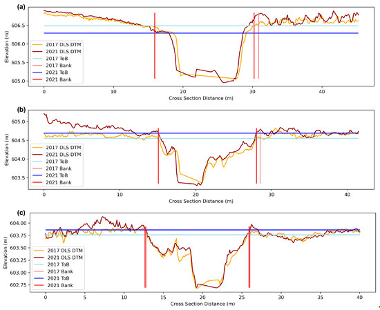
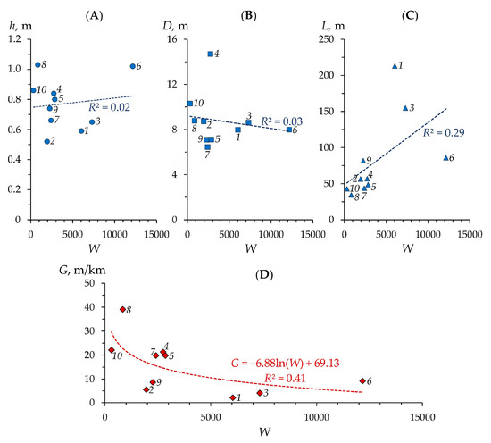
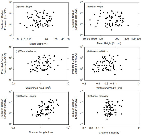
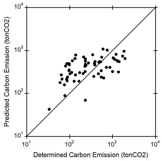
This study sought to estimate the potential impact of floodplain forest vegetation on sediment and phosphorus loading along the Iowa River in Iowa, USA. Thirty monitoring plots were established in forested conservation easements and similar public land along the Iowa River within the spatial extent of the two-, five-, and ten-year-flood return intervals. Within these plots, we examined the structure and cover of ground and overstory vegetation, as well as related metrics. Historic sediment and phosphorus fluxes were determined using a combination of sediment core extraction and tree ring analysis. The results show that deposition rates weakly correlate with tall grass and tall, medium, and short forb categories in the springtime but correlate with only short and medium grass and forb categories in late summer. Soil phosphorus concentration correlated weakly with overstory forest characteristics and springtime grass cover. Distance from the channel was negatively correlated with deposition. Overall, 4 to 50% (median = 15.5%) of the annual sediment load is represented by the deposition in adjacent floodplain forests. This study demonstrates the potential importance of floodplain easement forest vegetation in contributing to sediment and phosphorus attenuation during flood events.
Full article
(This article belongs to the Special Issue Advances in River and Floodplain Interactions)
►
Show Figures
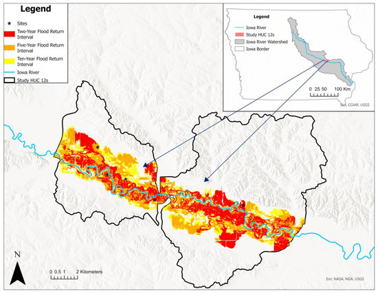
Figure 1


