


Water 2024, 16(8), 1158; https://doi.org/10.3390/w16081158 (registering DOI) - 19 Apr 2024
Abstract
The aim of this research is to propose a more sustainable swimming pool, in terms of water and energy, in the Costa Brava area. The methodology is focused on the creation of a descriptive water and energy model for swimming pools and their
[...] Read more.
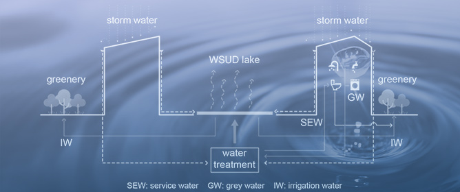
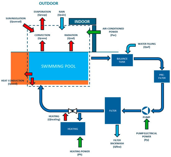
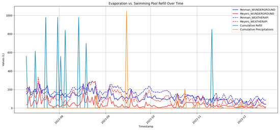
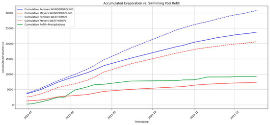
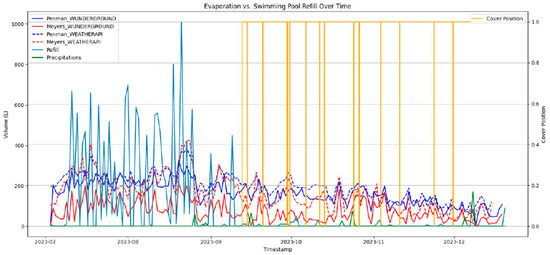
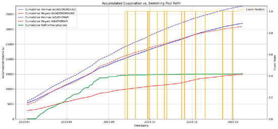
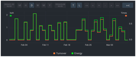
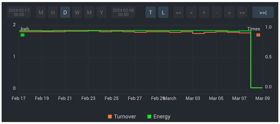
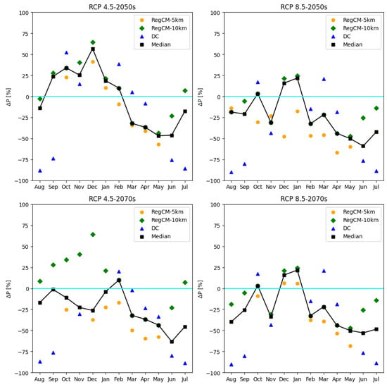
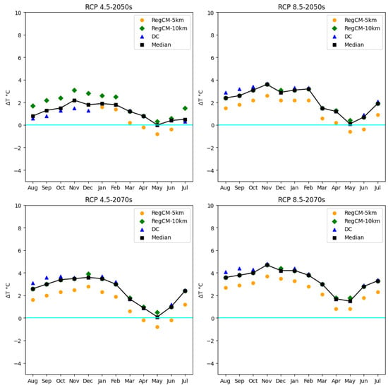
The aim of this research is to propose a more sustainable swimming pool, in terms of water and energy, in the Costa Brava area. The methodology is focused on the creation of a descriptive water and energy model for swimming pools and their monitoring, to propose the transition to a more sustainable swimming pool, in the context of climate change. The research is characterized by an exploratory, descriptive, and simulation approach to adapt swimming pools to the new requirements. Two significant impacts are highlighted from the perspective of water and energy stress—the carbon footprint, related to environmental impact and climate change, and the new business models of the sector, for a more sustainable tourism, with more sustainable pools. In terms of water balance, evaporation is an important variable and there are technical solutions on the market to control it, such as the use of covers. Furthermore, the modeling and simulation carried out helps to calculate the variable as a tool for improvement. For energy balance, in outdoor pools, pumping is an important variable and there are technologies, such as speed variation, that make it possible to reduce this. Furthermore, it should be noted that this research represents an important tool for the improvement of sustainability and operability for the various stakeholders, especially owners and governments, to face climate change, which is becoming increasingly critical for many regions.
Full article
(This article belongs to the Topic Hydrology and Water Resources Management)
►
Show Figures
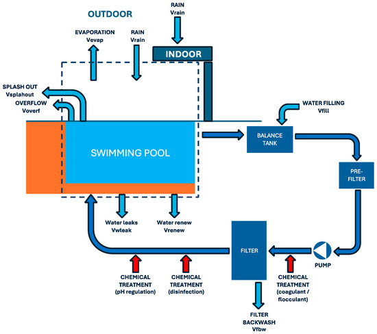
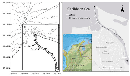
Figure 1


