


Water 2024, 16(8), 1165; https://doi.org/10.3390/w16081165 (registering DOI) - 19 Apr 2024
Abstract
Wave-induced currents play a critical role in coastal dynamics, influencing sediment transport and shaping bottom topography. Traditionally, long- and cross-shore currents in coastal zones were analyzed independently, often with two-dimensional models for longshore currents and undertow being used. The introduction of quasi-three-dimensional models
[...] Read more.
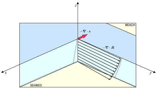
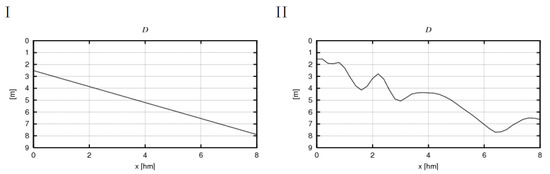
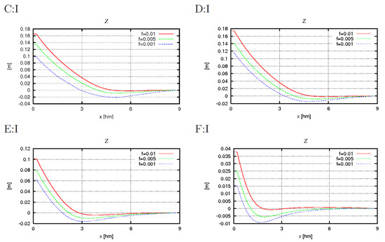
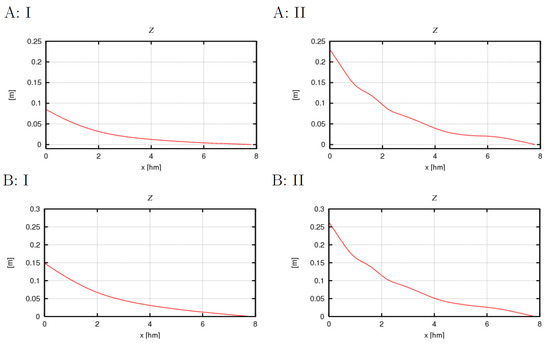
Wave-induced currents play a critical role in coastal dynamics, influencing sediment transport and shaping bottom topography. Traditionally, long- and cross-shore currents in coastal zones were analyzed independently, often with two-dimensional models for longshore currents and undertow being used. The introduction of quasi-three-dimensional models marked a significant advancement toward a more holistic understanding. Despite recent proposals for fully three-dimensional models, none have achieved widespread acceptance, primarily due to challenges in accurately capturing depth-dependent radiation stress. This paper presents an innovative analytical model advocating for comprehensive three-dimensional approaches in coastal hydrodynamics. The model, based on novel simplification rules, refines relationships governing turbulent stress tensors and provides valuable insights into wave-induced stresses. It offers analytical solutions for both homogeneous and general coastal zones, laying the foundation for future advancements in numerical modeling techniques.
Full article
(This article belongs to the Special Issue Coastal Management and Nearshore Hydrodynamics)
►
Show Figures

Figure 1


